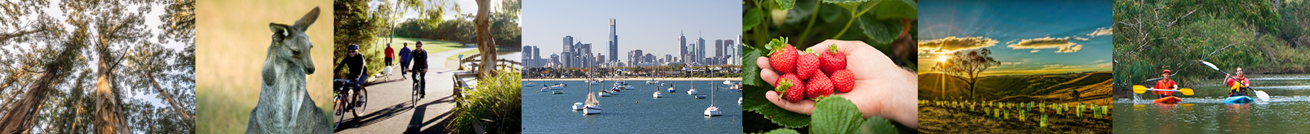
A precious asset
Port Phillip Bay is arguably the most important environmental, social and economic asset in the region; perhaps in all of Victoria. Its ecological services – climate control, boating, fishing, swimming, transport, effluent and stormwater treatment – are irreplaceable. The Bay is central to our whole region’s identity, culture and economy.
The people of the Kulin nation lived for 30,000 years on the grassy plain and woodlands where the Bay is today. Between 8,000 and 10,000 years ago, the ocean had covered the land bridge to Tasmania but the entrance to the Yarra plain was blocked with sand and silt. The waters of Bass Strait finally penetrated the barrier and Aboriginal oral histories describe the ocean’s dramatic creation of the Bay. First Peoples’ relationships with the Bay’s coastal and marine environments are recorded and preserved in the Bay’s hundreds of coastal cultural sites.
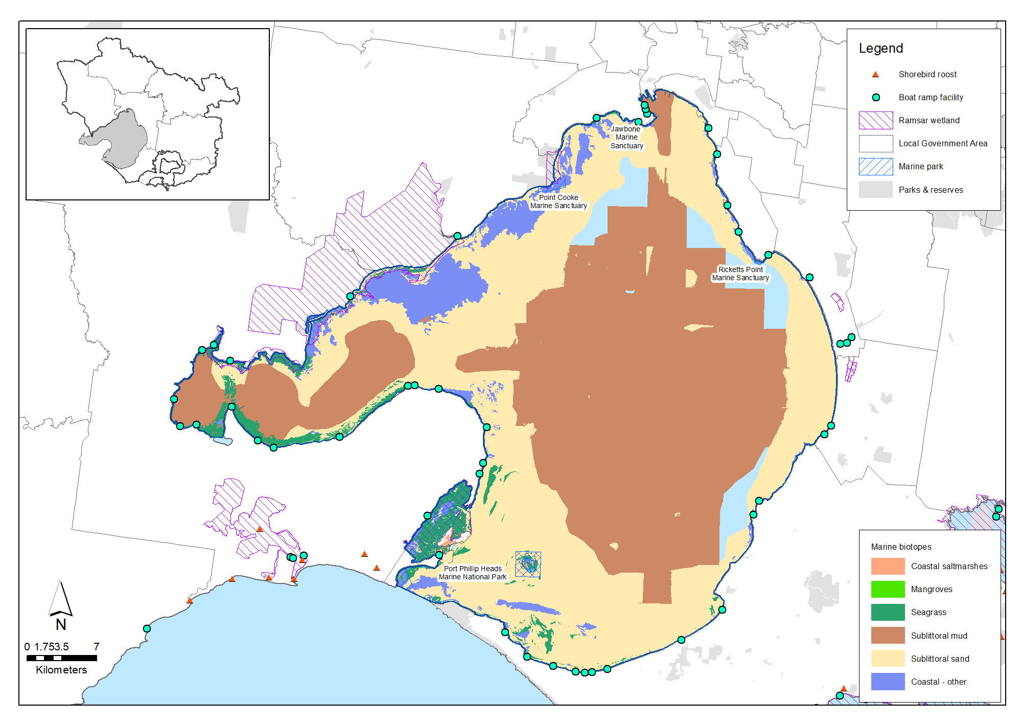
Port Phillip Bay is a large, shallow bay of 1,930 square kilometres. Nearly half the bay is less than eight metres deep and 24 metres marks its deepest point. Basalt rocky reefs formed from volcanic lava flows characterise the bay’s north-western inshore waters. Its western inlets, Corio Bay and Swan Bay, comprise shallow, exposed mangrove coastal saltmarsh, seagrass and tidal flats. This mosaic of freshwater and marine wetlands and the low-lying Mud Islands inside the Bay’s southern entrance comprise a wetland complex of international significance – the 22,650 hectare Port Phillip Bay (Western Shoreline) and Bellarine Peninsula Ramsar Site.
The journey across the Bay’s southern entrance on the Sorrento-Queenscliff ferry is one of the region’s great pleasures. The ferry crosses a wild environment of sea, sky and land between Bay and ocean. Marine creatures and birds are abundant here where 660 cubic kilometres of swirling tidal waters enter and leave the bay every year through the mile-wide ‘Rip’.
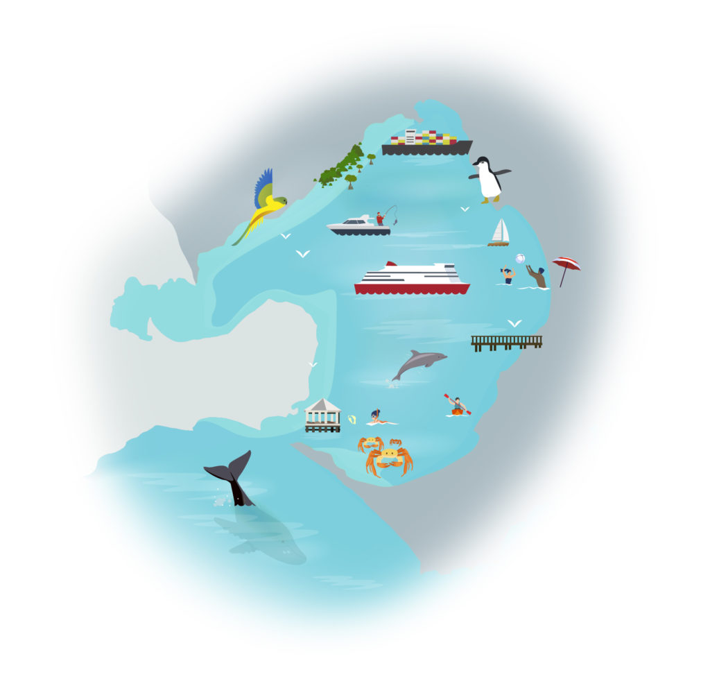
The Bays’ animal life includes unique species of seagrass, hundreds of fish species, molluscs, crustaceans, bristle worms, jellyfish, corals, sponges and seaweeds, making it one of Australia’s most diverse marine environments.
The Bay is Victoria’s biggest recreational fishery and its 135 beaches are part of life for many of Melbourne’s 5 million residents. They support recreations from swimming, snorkelling and scuba diving to fishing, sailing, motor boating kite-surfing ….. or just walking along its scenic edges.
At the other extreme, Australia’s busiest port, heavy industry, transport infrastructure and the City of Melbourne’s business district have transformed forever the land and waters of the Yarra estuary at the Bay’s most northern extent.
Port Philip Bay has changed a lot since Matthew Flinders first charted it during April and May in 1802. Five million people now live across the Bay’s drainage catchments and in Victoria’s two largest cities: Melbourne and Geelong. Despite this, the Bay’s water quality, biodiversity and amenity values remain in extraordinarily good condition. The Bay is a priceless inheritance.
Policy and planning
The Marine and Coastal Act 2018 (Vic) provides an integrated and coordinated approach to planning and managing Victoria’s marine and coastal environment. The Marine and Coastal Policy guides decision makers in the planning, management and sustainable use of Victoria’s marine and coastal environment. The first statewide Marine and Coastal Strategy includes an implementation plan identifying priority actions to be completed over the next five years, and outlines responsibility for delivery and timeframes.
Responsibility for planning and development on Port Phillip Bay’s coasts and seabed generally lies with the Department of Energy, Environment and Climate Action, which also oversees the legal accountabilities of several Coastal Committees of Management around the Bay.
The Port Phillip Bay Environmental Management Plan is the key planning document for environmental health of Port Phillip Bay. It is coordinated by the Department of Energy, Environment and Climate Action, and focuses action and investment on priority issues affecting Bay health.
The Department also coordinates Protecting Victoria’s Environment – Biodiversity 2037 – the Victorian Government’s statewide strategy to protect and improve biodiversity.
Victoria also has a system of Marine Protected Areas. In Port Phillip Bay there are five marine areas. These are managed by Parks Victoria. Parks Victoria also has responsibilities as the Local Port and Waterway Manager and has a Safety and Environmental Management Plan in place that covers Port Phillip Bay.
The Environment Protection Authority has a responsibility to protect the uses and values of Victoria’s environment by employing a range of measures consistent with its responsibilities under the new Environment Protection Act 2017 which commenced on 1 July 2021. The Act creates duties for all Victorians to protect our environment and human health from the impacts of pollution and waste. The EPA also performs several activities relevant to marine environments including monitoring recreational and marine water quality, regulating discharges to waterways and coastal waters, and reporting on the condition of the bays and catchments.
Port Phillip Bay’s catchment lands and coasts are generally managed by numerous local governments. They have a range of policies and plans in place that aim to protect and enhance the Bay’s cultural, social, environmental and economic values. The Councils that cover the coastal areas of the Bay cooperate through the Association of Bayside Municipalities that is focussed on protecting and sustainably managing the Bay for future generations,
Melbourne Water manages the waterways, wetlands and estuaries that feed into Port Phillip Bay. The Healthy Waterways Strategy 2018-28 provides vision statements, goals and performance objectives for waterway management in most catchments .
Traditional Owners are the voice for their Country
For all policy and planning, there is a need for recognition and inclusion of Traditional Owner knowledge and aspirations. The water and land are increasingly being recognised as ‘living and integrated natural entities‘ and the Traditional Owners should be recognised as the ‘voice of these living entities’.
A Country Plan is being prepared by the Bunurong Land Council Aboriginal Corporation which will describe the vision and priorities of the Traditional Owners for their area under their responsibilities as a Registered Aboriginal Party, including for a large area of the Bay and its eastern and northern coast.
The Wadawurrung Traditional Owners Aboriginal Corporation has developed its Paleert Tjaara Dja Country Plan that seeks respectful working and learning based on cultural knowledge and practices. The plan is particularly relevant to the western areas and coast of the Bay.
The condition of Port Phillip Bay now
Water quality
Water quality in Port Phillip Bay meets high standards. Five parameters are used by EPA Victoria to assess marine water quality; clarity, dissolved oxygen, nutrients, salinity and algal concentrations. The EPA Report Card 2018-19 assessed the Bay’s overall water quality as ‘Good’. Higher nutrient and salinity levels, due to dry weather, resulted in a ‘Fair’ rating for these parameters. Conditions in Port Phillip Bay have remained relatively steady since 2002 with overall annual water quality fluctuating between ‘Good’ to ‘Very Good’.
The Bay has a strong capacity to self-maintain good water quality. Its large volume, biological processes that remove nutrients and tidal exchanges with ocean waters overcome the effects of poor-quality water entering the bay from the Yarra, other waterways and the region’s urban drainage system. Toxic algal blooms would be regular crises for the Bay if it did not have these resilience features.
Over 26,000 kilometres of drains and street gutters carry stormwater from our catchments into Port Phillip Bay and Western Port. Much of this stormwater carries nutrients (mostly nitrogen and phosphorus-bearing compounds) and other pollutants. Limiting nutrient inputs to the Bay and protecting the biological process that strip nutrients from the water are critical tasks to protect almost every value we hold for the Bay.
Reducing annual nitrogen loads to the Bay by 1,000 tonnes was a key recommendation of a scientific study of the Bay in the mid-1990s. ‘Green engineering’ in vegetated gutters, stormwater soakage basins and constructed wetlands are part of the ongoing effort to remove pollutants from stormwater between its urban sources and the Bay. By 2017, major capital works at the Western (Sewage) Treatment Plant reduced annual nitrogen loads to the Bay by 500 tonnes and constructed wetlands and other water sensitive urban designs had stripped 109 tonnes from annual nitrogen loads in urban waterways.
Marine habitats
Habitats for around 300 fish species, hundreds of molluscs, crustaceans, bristle worms, jellyfish, corals and sponge species, two species of seagrass and at least 200 species of seaweed are supported by Port Phillip Bay’s diverse environments. 33 bird species of coastal waders, seabirds and coastal birds-of-prey are commonly seen around and on the Bay.
Five marine mammals are seen in the bay: Common dolphins (Delphinus delphis), and Burrunan dolphins (Tursiops australis) are resident or visitors. Orcas (Orcinus orca), Humpback whales and Southern right whales are seasonal visitors. The Burrunan dolphin population is small and unique. About 120 live in Port Phillip Bay and 65 in the Gippsland Lakes. The species is listed as ‘Threatened’ under the Victorian State Flora and Fauna Guarantee Act due to its small and isolated populations.
Australian fur seals are the dominant seal species in Port Phillip Bay. Seals are mostly seen at the southern end of the Bay, in the water or resting on navigation structures. Seals occasionally come ashore to rest on beaches. Port Phillip Bay is occasionally visited by other seal species including sub-Antarctic fur seals, Australian sea lions, southern elephant seals and leopard seals.
Marine protected areas
Port Phillip Bay features four marine protected areas managed by Parks Victoria.
The aim of these is to protect representative marine environments. All forms of commercial and recreational fishing are prohibited in Marine Protected Areas.
| Marine Protected Areas | Area | Features and values |
|---|---|---|
| Point Cooke Marine Sanctuary | 290 hectares | Diversity of sponges, sea-urchins, crustaceans, sharks and skate |
| Ricketts Point Marine Sanctuary | 115 hectares | Extensive sandstone intertidal platforms, subtidal reef, soft substrate, sand and seagrass habitats. Fifty-one species of fish have been identified. |
| Port Phillip Heads Marine National Park | 34,700 hectares | Internationally recognised dive and snorkel sites, made up of six separate marine area |
| Jawbone Marine Sanctuary | 30 hectares | The largest occurrence of mangroves in Port Phillip Bay |
Ramsar wetlands
The Port Phillip Bay (western shoreline) and Bellarine Peninsula Ramsar Site is a wetland of international importance for migratory birds and supporting biodiversity. The site comprises 22,650 hectares of freshwater and marine wetlands on the Bay’s western shore, parts of Corio Bay and the low-lying Mud Islands inside the Bay’s southern entrance.
The Ramsar Site Management Plan defines the site’s ecological character – the things that make it important:
- A total of 129 waterbird species have been recorded across the site 20 including species of waders listed under the international migratory bird agreements.
- Over 60 species of marine and estuarine fish have been recorded in saltmarsh and seagrass habitats including large number of pipefish, bridled leather jacket, spot-shoulder weed fish and cobble. Swan Bay is a significant nursery for King George whiting.
- The 1,225 hectares of coastal saltmarshes within the Ramsar site boundary are recognised for their plant diversity, ecological complexity and their importance as habitat for fish and roosting waterbirds.
- Seagrass is an important part of the site’s ecology at Pt. Wilson/Limeburners Bay, Swan Bay and Mud Islands.
Recreational fishing
Fishing for fun is a major activity on Port Phillip Bay. Over a half a million fishing trips were taken across the whole Port Phillip Region in 2018, the vast majority on Port Phillip Bay producing an estimated economic value of over $420 million per year.
This fishing effort appears sustainable for now. Fisheries Research & Development Corporation studies (2017) found fishing in Port Phillip Bay to be a much lower risk to the Bay’s ecological health than water pollution, coastal development and marine pest species.
Marine pests
Marine pests pose a critical threat to Port Phillip Bay’s ecological health. Agriculture Victoria reports that at least 99 pest species have been introduced to the Bay from known origins. A further 61 marine species have also been observed but are of unknown origin.
Pest organisms vary in size from large plants to micro-organisms and include algae, fishes, polychaetes, rotifers, nematodes, crustaceans, ascidians, bryozoans, bivalves, gastropods, hydroids and ciliates. Some, like Sabella worm and Undaria kelp, can dominate space and out-compete native species. Northern Pacific seastars are voracious predators or have adverse impacts on fish habitat and food chains. Dinoflagellate species can cause toxic algal blooms.
Many pests arrive as larvae in ballast water or as adult ‘hitch-hikers’ on ships that visit the port. Strict ballast water management controls were introduced to international and domestic shipping by the EPA Waste Management Policy (Ships Ballast Water) policy in 2004 and Regulations in 2006. Ballast water discharge is listed as a Threatening Process by the Fauna and Flora Guarantee Act 1988.
Aquaculture
Aquaculture for Blue mussels is undertaken in seven Aquaculture Fisheries Reserves at the Pinnace (Mud Island area), Dromana, Mt Martha, Beaumaris, Kirk Point and Grassy Point north of the Bellarine Peninsula and at Bates Point in Corio Bay. The reserves total 437 hectares. Individual farming sites ranging from 3 hectares to 27 hectares.
Port Phillip Bay accounts for about 90% of mussel aquaculture in Victoria. The state-wide industry produced 1,014 tonnes of mussels worth over $3 million in 2017.
The environmental impacts of mussel aquaculture were investigated for the Department of Primary Industries in 2007. The study concentrated on one farm of 3 hectares. It found the effects from long term mussel farming in Port Phillip Bay were likely to be small and restricted to the farmed area. This appeared to result from the relatively low production, 15-30 tonnes/hectar/year, of farms in Port Phillip Bay.
Challenges we face
Marine pests
Marine pests compete with native species for space and food, invade and alter habitats and, in Port Phillip Bay, could disrupt nitrogen processing by reducing the mass and/or effectiveness of the organisms vital to the process. Like introduced pests on land, marine pest populations can grow quickly and destructively.
The Northern Pacific Seastar (Asterias amurensis), a native of the northwest Pacific waters off Japan and Korea, is a voracious predator. Each adult female can produce up to 20 million eggs. It arrived in the Bay around 1995 and peaked in population in 2000 when it accounted for 56% of the Bay’s resident fish biomass. In the short-term, physical removal and trapping are the only control options.
The European Fan Worm (Sabella spallanzanii) is native to the Mediterranean. In Australian waters, it overgrows seagrass, competes for phytoplankton foods with native oysters, mussels and scallops and excretes nitrogen which could contribute to poor water quality. Dive surveys conducted in 1998 indicated that the European Fan Worm now occurs throughout Port Phillip Bay, especially on pier pylons and on the seabed to 7 metre depths.
Japanese Seaweed (Undaria pinnatifida) is also called Wakame in Japan where it has been cultivated for food for hundreds of years. Nominated among 100 of the world’s worst invasive species, it was found growing in Port Phillip Bay in 1996. Japanese seaweed can form dense forests, competing for light and space with native plants and animals and disrupting food chains. Physical removal of plants has limited success. Sea urchins graze on the seaweed but are not likely to offer a realistic biological control.
Three responses to marine pest invasion are described by the Port Phillip Bay Environmental Management Plan:
- Prevention through regulations for ballast water, shipping and fishing gear and education of boat owners to improve awareness and understanding of how to avoid spreading marine pests
- Monitoring priority locations for early detection of marine pest introductions
- Rapid responses to new marine pest incursions.
Climate change
Climate change is expected to have four main effects:
- Increased water temperatures are already creating changes to the distribution of marine plants and animals. Water temperatures will increase, leading to a change in species composition, and changing patterns of marine and coastal biological communities.
- Marine water will become more acidic as it absorbs increased atmospheric carbon dioxide from the atmosphere. This chemical change will increase the energy marine crustaceans and planktons need to create their calcium carbonate shells. The loss of these animals could have catastrophic effects on marine food chains and ecological systems.
- Global sea level rises are already being observed. Rises of between 0.18 to 0.59m by 2095 will flow to the Bay. Polar ice sheet melts of 0.1 to 0.2m is also possible. Storm surges will become more frequent and expose the coast to erosion and inundation. Port Phillip Bay’s beaches, intertidal zones and wetlands will be vulnerable to drowning. Rising sea levels will squeeze coastal habitat between the sea and urban development at the point where social pressure for coastal engineering protections like seawalls will be most intense. Space for coastal retreat onto private land is rare.
- Reduced river flows to Port Phillip Bay punctuated by more frequent and intense storms are predicted with high levels of confidence as the climate dries and warms. These changes increase pollution risks to the Bay. Long periods of low runoff concentrate litter, chemicals, sediment and organic pollutants in the catchment. These pollutant stores are moved by intense storms to the Bay where algal blooms feed on nutrient-rich inflows mixed with warm water and sunlight. This effect was observed during the Millennium drought.
Increasing pollution from land and catchment waterways
Urbanisation replaces ‘green’ surfaces with hard, impervious pavements, roads and buildings. Rain runs off these surfaces unabated into drains and waterways. Increased stormwater volumes and intensity destroy water quality in waterways with pollutants and replace their natural flows with flood-famine surges. Population growth is creating a bigger Melbourne with more hard surfaces. Estimates for the Healthy Waterways Strategy 2018-28 predict that the area of impervious surface in the region will grow by 59% in the next 50 years.
An example of an increasing issue is plastic pollution that has significant impacts beyond its costs as litter to aesthetics and amenity including:
- Injury and slow death for animals and birds that ingest plastics
- Greenhouse gas and leachable chemicals emissions from plastic litter as it degrades
- Plastics attract exterior films of toxic organic pollutants which then find their way into food chains
- Plastic chemicals bioaccumulate and biomagnify up food chains.
Vision and targets for the future
Vision
The Port Phillip Bay Environmental Management Plan has the following vision, targets and priorities:
A healthy Port Phillip Bay that is valued and cared for by all Victorians. Stewardship of the Bay is fostered across community, industry and government. Water quality is improved to ensure environmental health and community enjoyment of the Bay. The Bay’s habitats and marine life are thriving.
- Improve appreciation and understanding of Bay values and connections to catchment
- Improve collaboration and partnerships across community, industry and government
- Ensure nutrient and sediment loads do not exceed current levels and pollutant loads are reduced where practicable
- Reduce litter loads to the Bay
- Minimise risks to human health from pathogens
- Conserve and restore habitats and marine life
- Manage risks from marine pests.
In addition, the Association of Bayside Municipalities is committed to:
- Improving the water quality and coastal surrounds of the bay allowing for its continued enjoyment and sustainable use whilst ensuring the protection of the marine ecosystem
- Acting as a conduit and catalyst for information exchange in relation to the impacts of climate change to bayside councils, including sea level rise, storm surge and inundation
- Appropriate and sustainable coastal planning, development and land use
- Advocating for effective governance arrangements for the Bay
- Reflecting the community’s values for the bay as a place for recreation and enjoyment, advocating for safe clean beaches, appropriate water quality, sustainable recreational opportunities, appropriate land use, community accessibility, environment and open space values, the conservation of native terrestrial and marine life and protection against a changing climate and its impacts.
Regional Catchment Strategy targets
The following long-term targets for Port Phillip Bay (at the year 2050) will contribute to achieving the visions outlined above and help ensure the Bay remains healthy for future generations.
Partner organisations for the journey ahead
The following organisations formally support the pursuit of the Regional Catchment Strategy’s targets for Port Phillip Bay. They have agreed to provide leadership and support to help achieve optimum results with their available resources, in ways such as:
- Fostering partnerships and sharing knowledge, experiences and information with other organisations and the community
- Seeking and securing resources for the area and undertaking work that will contribute to achieving the visions and targets
- Assisting with monitoring and reporting on the condition of the area.
Traditional Owners
- Wadawurrung Traditional Owners Aboriginal Corporation
- Bunurong Land Council Aboriginal Corporation
Victorian Government
- Department of Energy, Environment and Climate Action
- Melbourne Water
- Parks Victoria
- Sustainability Victoria
- Victorian Fisheries Authority
- Environment Protection Authority Victoria (EPA)
- Yarra Valley Water
- South East Water
- Trust for Nature
- Victorian Environmental Water Holder
- Zoos Victoria
Local Government
- Association of Bayside Municipalities
- Wyndham City
- Moorabool Shire Council
- Hobsons Bay City Council
- Moonee Valley City Council
- Hume City Council
- City of Whittlesea
- Maroondah City Council
- City of Stonnington
- Northern Alliance for Greenhouse Action
- South East Councils Climate Change Alliance
- Monash City Council
- Bayside City Council
- City of Port Phillip
- City of Greater Geelong
- Kingston City Council
- Glen Eira City Council
- Knox City Council
- Whitehorse City Council
- City of Casey
- Western Alliance for Greenhouse Action
- Eastern Alliance for Greenhouse Action
Non Government
- Native Fish Australia (Vic)
- OzFish Unlimited
- Marine Mammal Foundation
- Dolphin Research Institute
- Field Naturalists Club of Victoria
- Victorian National Parks Association
- The Nature Conservancy
- Conservation Volunteers Australia
- Birdlife Australia
- The People and Parks Foundation
- Habitat Restoration Fund
Community
- Port Phillip EcoCentre
- Werribee River Association
- Hobsons Bay Wetlands Centre Inc.
- Friends of Lower Kororoit Creek Inc
- Jacksons Creek EcoNetwork
- Friends of Emu Bottom Wetlands Reserve
- Nillumbik Landcare Network
- Nangana Landcare Network
- Johns Hill Landcare Group
- Mornington Peninsula Landcare Network
Add your organisation as a supporter and partner
If your organisation supports these directions and targets for Port Phillip Bay, it can be listed as a partner organisation. Adding your organisation to this list will:
- Enable your organisation to list one or more priority projects in the Prospectus which will describe how your priority project will pursue the targets of this Regional Catchment Strategy and potentially make your organisation’s project more attractive to investors by using the strategy to highlight its relevance and value
- Demonstrate your commitment to a healthy and sustainable environment
- Demonstrate the level of community engagement and support for this work.
Priority projects to move forward
Priority projects
There are significant ongoing programs and initiatives undertaken by many organisations that are vital for the management of Port Phillip Bay. In addition, there are numerous project proposals that, if funded and implemented, can contribute to achieving the Regional Catchment Strategy’s visions and targets for the bay. Project proposals include:
- New shellfish reefs for Port Phillip Bay led by The Nature Conservancy
- Nairm Catchments Network proposed by the Port Phillip EcoCentre
- Project Burrunan led by the Marine Mammal Foundation
- Kelp habitat in Port Phillip Bay proposed by OzFish Unlimited
- A lifeline for Fairy Terns led by Birdlife Australia
- Mordialloc Creek Rehabilitation and Wetlands Project led by Melbourne Water
- Mulloway investigations led by Melbourne Water
- Patterson River Litter Trap led by Melbourne Water
- Port Phillip Bay western shoreline Ramsar site coordination proposed by Melbourne Water
A list of project proposals and their key details can be viewed and sorted on the Prospectus section of this website.
Propose a new priority project
As part of the ongoing development and refinement of this Regional Catchment Strategy, additional priority projects may be considered for inclusion in the Prospectus.
If your organisation supports the directions and targets for this area, and has a project it would like highlighted and supported in this Regional Catchment Strategy, please submit a Prospectus Project Proposal.